PTOLEMY – La Geografia di Claudio Tolomeo Alessandrino – 1561
Il prezzo originale era: €10,507.00.€7,355.00Il prezzo attuale è: €7,355.00.
Descrizione
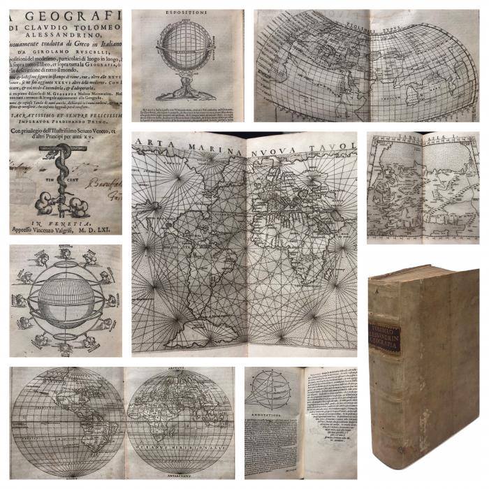
PTOLEMY – La Geografia di Claudio Tolomeo Alessandrino, nuovamente tradotta di Greco in Italiano, da Girolamo Ruscelli, con Espositioni del Medesimo, particolari di luogo in luogo, & universali sopra tutto il libro, et sopra tutta la Geografia, ò modo di far la descrittione di tutto il mondo. Et con nuove et bellissime figure in istampe di rame, ove, oltre alle XXVI antiche di Tolomeo, se ne son’aggiunte XXXVI altre moderne. Con la carta di navicare, et col modo d’intenderla, et d’adoperarla. Aggiuntovi un pieno discorso di M. Gioseppe Moleto Matematico. Nel quale si dichiarano tutti i termini & le regole appartenenti alla Geografia. Et con una nuova et copiosa Tavola di nomi antichi, dichiarati co i nomi moderni, et con molte altre cose utilissime et necessarie, che ciascuno leggendo potrà conoscere. Al Sacratissimo et sempre felicissimo Imperator Ferdinando Primo // (SECOND PART:) Espositioni et introduttioni universali, di Girolamo Ruscelli sopra tutta la Geografia di Tolomeo. Con XXXVI nuove Tavole in istampe di rame, così del mondo conosciuto dagli antichi, come del nuovo. Con la carta di Navicare, & con più altre cose intorno alla Cosmografia, così per mare, come per terra // (THIRD PART:) Discorso Universale di M. Gioseppe Moleto Matematico. Al Signor Federigo Morando, nel quale son raccolti, et dichiarati tutti i termini, et tutte le regole appartenenti alla Geografia – 1561. In Venetia, appresso Vincenzo Valgrisi. Full rigid vellum with gilded titles imprinted on a leather patch applied to the spine; octavo, 22.3 x 16 cm; 3 parts in 1 volume: pp. (8) 358 (2) (104) (128 cc.) 47; rare and irrelevant small holes of extinct woodworm, integrative restorations to the first title page and last page (application of paper flaps to integrate a previous cutout, probably in correspondence with an old membership note), halo at the outer margin of the cards, never invasive, present for good or bad throughout the volume, solid but slightly more ‘open’ binding in correspondence with the second part of the work, geographic maps all reinforced in correspondence of the fold at the back, overall good copy. Triple title page with Valgrisian typographic mark; talking woodcut initials; text also in italics; 13 woodcut figures in the text; 64 geographical copper engraved plates (21.5 x 28 cm, sheet size) on double page, in wrong order, all bound together with the nautical chart at the beginning, placed after the second part, but all present; also the ‘table’ and the ‘declaration’ erroneously bound after the second part. Note of belonging Baruffaldi (presumably Ambrogio, mathematician from Ferrara). First Valgrisian edition of the translation of Ruscelli which shows the map of the world separated into two hemispheres as well as the beautiful nautical map


